


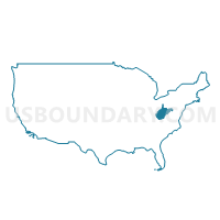
Ohio, Marshall, Hancock & Brooke Counties PUMA, West Virginia
About
Outline

Summary
| Unique Area Identifier | 194376 |
| Name | Ohio, Marshall, Hancock & Brooke Counties PUMA |
| State | West Virginia |
| Area (square miles) | 601.72 |
| Land Area (square miles) | 583.07 |
| Water Area (square miles) | 18.65 |
| % of Land Area | 96.90 |
| % of Water Area | 3.10 |
| Latitude of the Internal Point | 40.06809020 |
| Longtitude of the Internal Point | -80.62095670 |
Maps

Graphs
Select a template below for downloading or customizing gragh for Ohio, Marshall, Hancock & Brooke Counties PUMA, West Virginia


Neighbors
Neighoring Public Use Microdata Area (by Name) Neighboring Public Use Microdata Area on the Map
- Beaver County (South) PUMA, PA
- Belmont & Jefferson Counties PUMA, OH
- Columbiana County PUMA, OH
- Jackson, Wetzel, Roane, Braxton, Ritchie, Tyler, Gilmer & Calhoun Counties PUMA, WV
- Washington (South) & Greene Counties PUMA, PA
- Washington County (North)--Washington City PUMA, PA
- Washington, Morgan, Noble & Monroe Counties PUMA, OH
Top 10 Neighboring County (by Population) Neighboring County on the Map
- Washington County, PA (207,820)
- Beaver County, PA (170,539)
- Columbiana County, OH (107,841)
- Belmont County, OH (70,400)
- Jefferson County, OH (69,709)
- Ohio County, WV (44,443)
- Greene County, PA (38,686)
- Marshall County, WV (33,107)
- Hancock County, WV (30,676)
- Brooke County, WV (24,069)
Top 10 Neighboring County Subdivision (by Population) Neighboring County Subdivision on the Map
- Steubenville city, Jefferson County, OH (18,659)
- District 1, Ohio County, WV (16,752)
- District 3, Ohio County, WV (15,243)
- Pease township, Belmont County, OH (14,309)
- District 2, Ohio County, WV (12,448)
- District 3, Marshall County, WV (12,042)
- East Liverpool city, Columbiana County, OH (11,195)
- District 1, Marshall County, WV (10,892)
- Island Creek township, Jefferson County, OH (10,546)
- Grant district, Hancock County, WV (10,311)
Top 10 Neighboring Place (by Population) Neighboring Place on the Map
- Wheeling city, WV (28,486)
- Weirton city, WV (19,746)
- Steubenville city, OH (18,659)
- East Liverpool city, OH (11,195)
- Moundsville city, WV (9,318)
- Martins Ferry city, OH (6,915)
- Toronto city, OH (5,091)
- Bellaire village, OH (4,278)
- Shadyside village, OH (3,785)
- Wellsville village, OH (3,541)
Top 10 Neighboring Unified School District (by Population) Neighboring Unified School District on the Map
- Ohio County School District, WV (44,443)
- Marshall County School District, WV (33,107)
- Hancock County School District, WV (30,676)
- Brooke County School District, WV (24,069)
- Indian Creek Local School District, OH (19,265)
- Switzerland of Ohio Local School District, OH (17,913)
- East Liverpool City School District, OH (16,597)
- Wetzel County School District, WV (16,583)
- Steubenville City School District, OH (16,157)
- Edison Local School District, OH (15,355)
Top 10 Neighboring State Legislative District Lower Chamber (by Population) Neighboring State Legislative District Lower Chamber on the Map
- State House District 93, OH (116,725)
- State House District 1, OH (107,841)
- State House District 95, OH (106,820)
- State House District 46, PA (62,516)
- State House District 50, PA (59,028)
- State House District 49, PA (58,268)
- State House District 15, PA (57,350)
- State House District 14, PA (55,975)
- State House District 2, WV (34,538)
- State House District 4, WV (33,317)
Top 10 Neighboring State Legislative District Upper Chamber (by Population) Neighboring State Legislative District Upper Chamber on the Map
- State Senate District 20, OH (357,708)
- State Senate District 30, OH (338,710)
- State Senate District 46, PA (235,908)
- State Senate District 47, PA (225,797)
- State Senate District 2, WV (101,327)
- State Senate District 1, WV (95,975)
Top 10 Neighboring 111th Congressional District (by Population) Neighboring 111th Congressional District on the Map
- Congressional District 18, PA (653,385)
- Congressional District 4, PA (647,418)
- Congressional District 6, OH (623,742)
- Congressional District 1, WV (615,991)
- Congressional District 12, PA (612,384)
Top 10 Neighboring Census Tract (by Population) Neighboring Census Tract on the Map
- Census Tract 210, Marshall County, WV (6,537)
- Census Tract 7310, Washington County, PA (6,053)
- Census Tract 209, Marshall County, WV (5,299)
- Census Tract 18, Ohio County, WV (5,261)
- Census Tract 311.01, Brooke County, WV (5,213)
- Census Tract 211, Marshall County, WV (5,096)
- Census Tract 20, Ohio County, WV (5,060)
- Census Tract 110, Belmont County, OH (5,009)
- Census Tract 208, Marshall County, WV (4,741)
- Census Tract 215, Hancock County, WV (4,619)
Top 10 Neighboring 5-Digit ZIP Code Tabulation Area (by Population) Neighboring 5-Digit ZIP Code Tabulation Area on the Map
- 26003, WV (43,002)
- 43920, OH (23,438)
- 26062, WV (21,801)
- 43952, OH (19,050)
- 26041, WV (16,183)
- 43964, OH (9,575)
- 43935, OH (8,943)
- 26155, WV (8,823)
- 43906, OH (8,678)
- 26070, WV (8,441)